Climb Kilimanjaro Lemosho Route

Conquering Kilimanjaro: An 8-Day Journey Along the Lemosho Route

Kilimanjaro, the rooftop of Africa, has long been a magnetic summit for trekkers and mountaineers worldwide. Among the several paths that snake their way up the mountain, the Lemosho route has gained a reputation as one of the most scenic and successful paths to the snow-capped peak. If you’re considering embarking on this journey, here’s a comprehensive guide to scaling the heights via the Lemosho route.

Introduction to the Lemosho Route

The Lemosho route is a relatively new trail compared to the more established Marangu and Machame routes. It begins on the western side of Mount Kilimanjaro and has quickly become a favorite for its remote atmosphere, natural beauty, and high summit success rate.

Spanning approximately 70 kilometers (42 miles), it takes climbers through a diverse range of ecosystems, from rainforest and heath to alpine desert and glaciers. Due to its longer itinerary, usually 7 to 8 days, it allows for better acclimatization and provides hikers with more time to soak in the stunning vistas.

Why Choose the Lemosho Route?

The Lemosho route, often heralded for its natural beauty and pristine wilderness, begins on the western side of Kilimanjaro. It is a longer route, which allows for better acclimatization and subsequently, a higher success rate. This path takes climbers through a variety of ecosystems, from the rich montane forest to the stark alpine desert, before reaching the icy summit. It merges with the Machame route on the third day, offering a balanced mix of solitude and camaraderie with other climbers.


8 Days Kilimanjaro Climbing Lemosho Route

Day 1: From Lemosho Gate to Big Tree Camp (Mti Mkubwa)

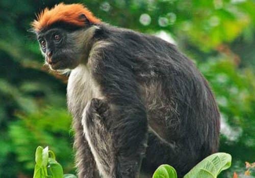
The journey begins at Lemosho Gate, situated at an altitude of 2,100 meters (6,890 feet). After completing the necessary registration with the park authorities, trekkers delve into the lush rainforest that marks the start of the Lemosho Route. This day’s trek is relatively short, taking about 3 to 4 hours to reach the Big Tree Camp, also known as Mti Mkubwa, located at 2,780 meters (9,120 feet). The path is gentle yet enchanting, with the possibility of spotting blue monkeys and hearing the distant calls of Colobus monkeys. As hikers settle in for their first night on the slopes of Kilimanjaro, the mix of excitement and apprehension is palpable under the dense canopy of ancient trees.

Day 2: To Shira 1 Camp

With the second sunrise, trekkers embark on a more challenging hike towards the Shira Plateau. The climb takes around 6 to 7 hours, covering a terrain that transitions from rainforest to heather and moorland, offering stunning views and the chance to observe the unique flora, such as giant lobelias and senecios. Reaching the Shira 1 Camp at 3,505 meters (11,500 feet), hikers can witness the wide-open skies and the silhouette of Kibo, Kilimanjaro’s highest peak, in the distance. This is the first night spent above the 3,000-meter mark, and it is essential to pay attention to the body’s response to altitude.

Day 3: Shira 1 to Shira 2 Camp

Though shorter in distance, the hike from Shira 1 to Shira 2 Camp is instrumental for acclimatization. It takes about 3 to 4 hours of hiking through a gentler gradient compared to the previous day. This segment allows trekkers to marvel at the sweeping Shira Plateau, one of the largest high-altitude plateaus in the world. The journey to the Shira 2 Camp, situated at 3,840 meters (12,600 feet), is usually accompanied by a detour to the Shira Cathedral, which serves as an acclimatization hike and offers an extraordinary panoramic view of the surrounding landscape.

Day 4: To Barranco Camp via Lava Tower

This is a pivotal day for acclimatization as the trail leads to the Lava Tower at 4,630 meters (15,190 feet) before descending to the Barranco Camp at 3,960 meters (12,990 feet). The day is long, usually taking about 7 to 8 hours of hiking through the alpine desert ecosystem. The trek to the Lava Tower provides trekkers with the opportunity to test their reaction to high altitude, and the subsequent descent to Barranco Camp is critical for the “climb high, sleep low” method of acclimatization.

As hikers retire to their tents nestled in the Barranco Valley, they tighten their resolve while facing the Barranco Wall — an imposing barrier they will have to overcome the following day.

Day 5: Overcoming the Barranco Wall to Karanga Camp

Despite its daunting appearance, the Barranco Wall is a manageable obstacle, and most climbers find this part of the route to be extremely rewarding. Scaling the “Breakfast Wall” takes about 1 to 2 hours of scrambling, during which climbers use their hands for balance and leverage. Upon reaching the top, trekkers are treated to some of the most iconic views of the journey, including a surreal perspective of Kibo looming above.

The trek then leads to the Karanga Camp at 3,995 meters (13,106 feet). The journey from Barranco to Karanga takes about 4 to 5 hours, during which trekkers traverse valleys and ridges with breathtaking vistas, further exposing them to the stark beauty of the mountain’s higher elevations.

Day 6: To Barafu Camp

Following a relatively short and steady climb from Karanga, hikers arrive at the Barafu Camp, located at 4,673 meters (15,331 feet). The 3 to 4-hour trek to Barafu traverses an alpine desert landscape devoid of vegetation; the stark, rocky scenery underlines the altitude reached. Barafu Camp is the staging point for the summit push. It’s essential to rest, hydrate, and prepare mentally and physically for the nighttime ascent to Uhuru Peak.

Day 7: Summit Day - To Uhuru Peak and Down to Mweka Camp

Summit day begins in the wee hours, with climbers departing Barafu Camp around midnight. The steep, strenuous climb to the summit unfolds under starlit skies, with the trekkers’ headlamps flickering in the darkness like a procession of fireflies. After about 6 to 8 hours, the crater rim comes into view, and with it the first blush of dawn. Stella Point, at 5,756 meters (18,885 feet), offers a brief respite before the final hour-long push to Uhuru Peak.

At the summit, emotions run high as climbers embrace, take photos, and generally bask in the glory of their accomplishment — standing atop the highest point in Africa. After savoring the moment, it’s time for the descent, first back to Barafu Camp for rest and then continuing down to Mweka Camp at 3,100 meters (10,170 feet). This long day of climbing and descending is exhausting but rewarding beyond measure.

Day 8: Descending to Mweka Gate

The final day of the trek is a descent of 3 to 4 hours through lush forest to Mweka Gate at 1,640 meters (5,380 feet). Helichrysums and other hardy alpine plants give way to the dense greenery of the rainforest. Reaching the gate, a sense of extraordinary achievement pervades as trekkers reflect on the magnitude of what they’ve experienced. Climbers receive their summit certificates and say goodbye to their guides and porters who have become companions and cheerleaders along the way.

RATES 

Solo climber: $ 2290
2 people: $ 2060 per person
3+people: $ 1990 per person

Enquire Now


Preparing for the Kilimanjaro Climb

Training

Your Kilimanjaro climbing adventure begins long before you set foot in Tanzania. Preparing your body is crucial to your success and enjoyment of the trek. Cardiovascular activities such as running, cycling, and swimming are excellent for building stamina. Additionally, incorporate strength training and hiking with a weighted backpack to condition your body for the daily trek with gear.

Gear

Packing proper gear is essential. Layering is key, so include moisture-wicking base layers, insulating mid-layers, and waterproof outer layers. Don’t forget your headlamp, sun protection, and broken-in hiking boots. A comprehensive gear list should include warm clothing, gloves, a warm hat, and a sleeping bag rated for at least -10 degrees Celsius (14 degrees Fahrenheit).

Altitude Sickness

Be aware of altitude sickness signs, which include headaches, nausea, and dizziness. To mitigate the risk, stay hydrated, get plenty of rest, and consider discussing altitude sickness medication with your doctor

Lemosho Route Cost Includes

2 Nights accommodation at Keys Hotek on BB
Private professional mountain guides
All Park fees
Rescue fees
All meals while on the Mountain
Arrival and Departure transfers
Government taxes, VAT and all relating service charges
Guides, Porters, cook salaries and park fees
Summit Oxygen
Walking Sticks
Camping Gears

Lemosho Route Cost Excludes

Tanzania Visa: $50 per person on arrival
Personal Expenses (e.g. laundry, telephone, beverages, etc.)
Meals not listed above
Optional Tours (short safari after your climb etc)
Tips and any items of personal nature.
Emergency Evacuation by Flying Doctor

Amani Nature Reserve Hiking Tour

Amani Nature Reserve Hiking Tour

Amani Nature Reserve Hiking Tour

Discover the exquisite beauty and rich biodiversity of Amani Nature Reserve, a hidden gem in Tanzania that offers unparalleled experiences for nature lovers and adventurers alike.

Amani Nature Reserve is not just a destination; it is a sanctuary where the spirit of nature thrives in vibrant hues. Nestled in the lush hills of Tanzania, this reserve beckons to all nature enthusiasts, adventurers, and those seeking solace in the soothing embrace of nature. With its breathtaking rainforests, exotic wildlife, and a rich tapestry of cultures, Amani presents a surreal, enchanting retreat that captivates the heart and soul. Join us as we delve into the wonders of Amani Nature Reserve, where every corner uncovers a new marvel waiting to be explored.

Amani Nature Reserve

Enquire Now


Location and Natural Diversity of Amani Nature Reserve

The Amani Nature Reserve is a protected area located at Muheza and Korogwe Districts in the Tanga Region of Tanzania. Its exceptional biodiversity hotspot showcases the country’s stunning natural habitats. The nature reserve was founded in 1997 to protect the distinct plant and animal life of the East Usambara Mountains. Together with the West Usambara Mountains, they form a significant biodiversity hotspot. The reserve’s geographical features include an elevation that ranges from 900 to 2,000 meters above sea level, resulting in a diverse climate conducive to a rich array of ecosystems. The tropical climate, characterized by significant rainfall, supports lush forests that harbor a myriad of flora and fauna, making Amani a treasure trove for nature enthusiasts and researchers alike. Known for its unique cloud and montane forests, the area exhibits a surreal landscape, a distinctive hallmark of its location amidst the mountainous terrain.

Biodiversity in Amani Nature Reserve is truly extraordinary, with the area boasting over 400 species of plants, many of which are endemic to the region. Additionally, the reserve is home to a multitude of wildlife, including various species of birds, mammals, insects, and reptiles. Among the endemic species found in this reserve and the Usambara Mountains include, the Usambara three-horned chameleon, Nduk eagle owl and the famous African violet (Saintpaulia). Bird watchers will find Amani particularly enticing as it hosts more than 200 recorded bird species, among them are the Uluguru violet backed, forest warbler and the beautifully rare Amani Sunbird. This notable concentration of biodiversity not only serves as a vital refuge for numerous species, but it also plays a crucial role in the ecological balance of the region, contributing to global conservation efforts.

Activities at Amani Nature Reserve

Visitors to Amani Nature Reserve are treated to a range of activities that highlight the area’s natural beauty and cultural heritage. Well-marked nature trails take adventurers through breathtaking landscapes, offering ample opportunities for hiking and bird watching. Guided tours provide educational insights into the ecological significance of the reserve and the conservation work being undertaken. Additionally, interactions with local communities offer travelers a glimpse into the traditional lifestyles and customs of the peoples living in harmony with their natural surroundings.

The Hiking Trails

Amani Nature Reserve offers several hiking trails, each providing a unique perspective of the reserve’s rich biodiversity and landscapes. Here are some of the most popular routes

Nkulumo Trail

Length: 5 km | Duration: 2-3 hours

The Nkulumo Trail is perfect for those seeking a relatively easy hike. It takes you through dense forests, past a historical German-built reservoir, and offers stunning views of the lowlands. Birdwatchers will particularly enjoy this trail, as it’s common to spot some of the reserve’s endemic bird species.

Mbomole Hill Trail

Length: 6 km | Duration: 4-5 hours

For those looking for a bit more challenge, the Mbomole Hill Trail offers just that. It winds up to the summit of Mbomole Hill, providing breathtaking panoramic views of the surrounding area. Along the way, you’ll pass through lush forest and tea plantations, offering a glimpse into the local agricultural practices.

Derema Waterfall Trail

Length: 7 km | Duration: 5-6 hours

The Derema Waterfall Trail is arguably the most scenic, leading hikers to the spectacular Derema Waterfall. The trail can be quite steep and slippery in places, so it’s best suited for those with moderate hiking experience. The reward is a serene spot to relax and enjoy the sights and sounds of the waterfall.

Amani Forest Reserve

Best Time to Visit Amani Nature Reserve

Amani Nature Reserve in Tanzania offers diverse experiences throughout the year. The best time for wildlife observation is during the dry season, from June to October, as animals gather around water sources. In contrast, the wet season, particularly from March to May, brings lush scenery and migratory birds, making it ideal for birdwatchers seeking a serene experience.

Available Accommodations

Accommodations near the reserve cater to various preferences and budgets, including eco-lodges and simple campsites. It’s advisable to book in advance during peak seasons to secure desired options. Enhancing your visit with guided tours can enrich your understanding of the reserve’s ecology and conservation efforts. Additionally, take the time to explore the many trails, botanical gardens, and nearby waterfalls, revealing the reserve’s beauty.

6 Days – Amani Nature Reserve (Magoroto Forest) and Pangani Beach

Day 1: Arusha – Amani Nature Reserve
Your journey begins in the morning at 6:00 AM with a pickup from your hotel in Arusha, followed by a drive to Amani Nature Reserve, arriving around noon. During your visit, you’ll explore the Delema waterfalls. Afterward, you can enjoy lunch and some time to relax. Before dinner, there will be a night walk through the lush forest, allowing you to witness the rich biodiversity of this eastern region. This tour is sure to delight nature enthusiasts. Dinner and overnight accommodations are included.
Meals: Lunch | Dinner

Day 2: Amani Nature Reserve – Magoroto Forest
After breakfast, you’ll take a guided tour of the botanical garden (Mbomole Trail) in Amani. Following this, you’ll have the chance to unwind before enjoying a packed lunch, after which you’ll head to the Chemka waterfalls trail, where you can discover various endemic plants and spices. Post-lunch, you will proceed to Magoroto Forest, where you’ll embark on a hike to a viewpoint at 650 meters above sea level, followed by a visit to the waterfalls. Dinner and overnight accommodations will be at Mathias Cabins, situated at an altitude of 895 meters above sea level.
Meals: Breakfast | Lunch | Dinner

Day 3: Amani Nature Reserve – Magoroto Forest
Start your day with breakfast at Mathias Cabins, then hike to the spice farm, where you can learn about and taste organic spices such as black pepper, cocoa, vanilla, and cardamom. Afterward, you will head to the lakeside for swimming and other recreational activities. Lunch and dinner will be provided at the lakeside.
Meals: Breakfast | Lunch | Dinner

Day 4: Magoroto Forest – Pangani Coast
Following breakfast at Magoroto, you will drive to the Amboni caves, passing through Tanga Town. A knowledgeable guide will lead you on a tour of the caves, explaining the impressive formations of stalactites and stalagmites. After an hour of exploration, you will drive back to Tanga for lunch, and then continue your journey to the historic Pangani Coast. Dinner and overnight accommodations are included.
Meals: Breakfast | Lunch | Dinner

Day 5: Pangani Coast
After breakfast, you’ll kick off your day with a boat excursion to Maziwe Island for a day of beach relaxation, snorkeling, and swimming in the stunning turquoise waters with pristine white sand. Lunch will be served on the island. Dinner and overnight accommodations are included.
Meals: Breakfast | Lunch | Dinner

Day 6: Pangani Coast – Arusha
Enjoy breakfast before making the return drive to Arusha or continuing on to your next destination.
Meals: Breakfast
Accommodation: N/A


Package Includes:

  • Airport transfers
  • 2 nights in the hotel at Dar es Salaam
  • Reserve Entrance fees
  • 3 nights accommodation at Emau Hill Forest Campsite with three meals a day
  • Transport in a 4WD Safari vehicle
  • 4 nights accommodation at Mkoma Bay Tented lodge HB.
  • Airport transfers on the arriving and departing day at Dar es Salaam.
  • Salary for the Professional English Drive Guide & armed ranger
  • Activities as per itinerary above.


Amani Nature Reserve Package Excludes:

  • Airport transfers
  • International flight
  • Airport departure tax
  • Hot and cold drinks
  • Flying doctors insurance

Trekking Udzungwa Mountains

Trekking Udzungwa Mountains

Trekking Udzungwa Mountains

Trekking Udzungwa Mountains: An Unforgettable 3-Day Adventure Through Mwanihana Trail

Are you seeking a unique and immersive trekking experience far from the crowded trails of Kilimanjaro and Meru? Then pack your bags and prepare to be captivated by the Udzungwa Mountains, a hidden gem in Tanzania’s southern highlands. This article will guide you through the wonders of trekking Udzungwa Mountains, specifically focusing on the popular Mwanihana Trail, detailing what you can expect, how to prepare, and why this adventure should be on your bucket list.

About Udzungwa Mountains and the Mwanihana Trail

The Udzungwa Mountains National Park is a biodiversity hotspot, renowned for its rich endemic flora and fauna. Often referred to as the “Galapagos of Africa,” this park boasts a stunning array of landscapes, from lush rainforests and cascading waterfalls to miombo woodlands and montane grasslands. The Mwanihana Trail is one of the park’s most accessible and rewarding trails, offering a challenging yet manageable trek through the heart of this natural paradise.

This trail is typically a 3-day adventure, allowing ample time to soak in the surroundings and spot the unique wildlife that calls Udzungwa home. It’s a moderately strenuous trek, suitable for those with a reasonable level of fitness and a passion for nature.

Attractions and Wildlife on the Mwanihana Trail

One of the main draws of trekking Udzungwa Mountains is the incredible biodiversity you’ll encounter. On the Mwanihana Trail, be prepared to be amazed by:

  • Primates: Udzungwa is home to several primate species, including the endemic Iringa Red Colobus and Sanje Mangabey, both of which you have a good chance of spotting.
  • Birds: Birdwatchers will be in heaven with over 400 species recorded in the park, including several endemic ones like the Rufous-winged Sunbird and Udzungwa Forest Partridge.
  • Waterfalls: The trail leads you past stunning waterfalls, including the Sanje Waterfalls, cascading down hundreds of meters. These falls offer breathtaking views and refreshing swimming opportunities.
  • Flora: The diverse vegetation is a sight to behold, with giant trees, colorful orchids, and unique plant species at every turn.
  • Other Wildlife: Keep an eye out for other residents like elephants, buffalos, leopards, and various antelope species, though sightings are less frequent due to the dense forest.
Trekking Udzungwa Mountains

Accommodation During Trekking the Mwanihana Trail

Accommodation during trekking Udzungwa Mountains through Mwanihana Trail is typically in public campsite within the park. This campsite provides a safe and comfortable camping ground where you can perch your tents and  rest after a day of trekking. You can expect:

    • Tented Campsite: You’ll be sleeping in dom tents, provided by us or that you bring yourself.
    • Basic Toilet Facilities: Pit latrines are usually available at the campsites.
    • Designated Cooking Areas: Your private cook and porters will prepare meals in designated cooking areas.
    • No Electricity: Be prepared for no electricity in the campsites, so bring headlamps or flashlights.

While the accommodation is basic, it adds to the adventurous and immersive experience of trekking Udzungwa Mountains.

Trekking Udzungwa Mountains: A 3-Day Mwanihana Trail Program

Day 1: Arrival and Sanje Waterfall Hike

    • Arrive at Udzungwa Mountains National Park headquarters.
    • Meet your guide and porters, and receive a briefing about the trek.
    • Transfer to Sonjo village which is starting point to begin the hike to Njia panda ranger post / campsite, enjoying the lush rainforest scenery.
    • While trekking along Mwanihana trail you can encounter animals such as elephants and buffalos thats why you will be accompaned by armed ranger through out the trek
    • Camp at Njia Panda public ranger post.

Day 2: Ascent to Mwanihana Peak and Forest Exploration

    • After breakfast, begin the ascent towards Mwanihana Peak, passing through diverse vegetation zones.
    • Keep an eye out for primates and birds along the way.
    • Reach a high point on the Mwanihana Ridge, offering panoramic views (weather permitting).
    • Explore the surrounding forest, learning about the unique flora and fauna from your guide.
    • After spending sufficient time at the peak descend down back to the camp for dinner and overnight 

Day 3: Descent and Departure

    • Enjoy a final morning in the Udzungwa Mountains, savoring the sights and sounds of the forest.
    • Begin the descent back towards Sonjo village, the trekking starting point where you will picked and transfered back to park headquarters where you will arrive in the afternoon.
    • Departure.

Cost For Trekking Udzungwa Mountains

Trekking Package Includes:

    • Trekking permit at Udzungwa
    • Service of the guide, an armed ranger, private cook and porters
    • Camping gears (tents, chairs and table)
    • Meals (breakfast, lunch and dinner)
    • Transfer from the Lodge to Mwanihana Trail

Trekking Package Excludes

    • Accommodation at Dar es Salaam
    • Transfer from Dar es Salaam / Mikumi / Iringa to Udzungwa Mountains
    • Flying doctors services
    • Any expenses of the personal nature

Enquire Now


FAQs About Trekking Udzungwa Mountains

What is the best time to trek Udzungwa Mountains?

The dry season (June to October) is generally considered the best time to trek Udzungwa Mountains, as the trails are less muddy and the weather is more predictable. However, the park can be visited year-round.

How difficult is the Mwanihana Trail?

The Mwanihana Trail is considered moderately challenging, with some steep climbs and uneven terrain. A reasonable level of fitness is required.

What should I wear for trekking?

Wear sturdy hiking boots, lightweight and quick-drying clothing, and waterproof outerwear. Bring layers as the temperature can fluctuate.

What is the risk of malaria in Udzungwa Mountains?

Udzungwa Mountains is a malaria zone, so it’s essential to take malaria prophylaxis as prescribed by your doctor.

Can I trek independently in Udzungwa Mountains?

No, it is mandatory to hire a local guide for trekking Udzungwa Mountains.

Trekking Udzungwa Mountains offers an unparalleled opportunity to experience the raw beauty and biodiversity of Tanzania’s southern highlands. The Mwanihana Trail provides a challenging yet rewarding adventure, allowing you to immerse yourself in the lush rainforest, spot unique wildlife, and witness stunning waterfalls. With careful planning and preparation, your trekking Udzungwa Mountains adventure will be an unforgettable journey into the heart of Africa. So, are you ready to answer the call of the wild? Let Udzungwa Mountains enchant you!

7 Days Rongai Route Kilimanjaro

7 Days Rongai Route Kilimanjaro

7 Days Rongai Route Kilimanjaro

Discovering Kilimanjaro’s Rongai Route: A Journey to the Roof of Africa

Rongai Route Kilimanjaro

Standing tall and proud, Mount Kilimanjaro is Africa’s highest peak and one of the world’s most famous trekking destinations. Among the various routes that lead to its snowy summit, the Rongai Route holds a special place for those seeking a quieter, more remote path to the top.

Kilimanjaro’s Rongai Route is a gem in the crown of trekking routes to the summit. Its remote location, gentle gradient, and high success rate make it an attractive option for climbers from around the world. Remember that summiting Kilimanjaro is a feat that requires preparation, perseverance, and respect for the mountain. If you choose the Rongai Route, take your time to savor the experience, and no matter how far you get, the journey itself will be a reward to remember.

The Rongai Route is located on the northeastern side of Mount Kilimanjaro, near the Kenyan border. Unlike the other trails which start on the southern side of the mountain, the Rongai Route offers a unique perspective, starting from the remote village of Nale Moru. Its location makes it the only route that approaches Kilimanjaro from the north and provides a different climatic experience, with the drier northern slopes seeing less precipitation than the southern counterparts.

Rongai Route Distance & Elevation

Spanning approximately 70 kilometers (43 miles) round trip, the Rongai Route offers a relatively gentle gradient compared to other routes, making it a good option for trekkers who prefer a less strenuous ascent. The journey begins at an altitude of about 1,950 meters (6,398 feet) and gradually winds its way through farmlands, pine forests, and alpine meadows before reaching the edge of the moorland zone where the stunning views of the Kenyan plains unfold.

As trekkers ascend, they reach the Second Cave at 3,450 meters (11,319 feet) and then cross the saddle between Mawenzi and Kibo, two of Kilimanjaro’s volcanic cones. The trail continues to Kibo Hut at 4,700 meters (15,420 feet), which serves as the base camp for the final summit push. The last stretch to Uhuru Peak, the highest point at 5,895 meters (19,341 feet), is the most challenging part of the trek but also the most rewarding with the spectacular sunrise views over the African plains.

Rongai Route Success Rate

The Rongai Route boasts one of the highest summit success rates compared to other paths on Kilimanjaro, partly due to its gentle slope that allows climbers to ascend slowly and acclimatize more effectively. While no official statistics are available, estimates suggest that the success rate for the Rongai Route is between 70% to 85%.

One of the factors contributing to this high success rate is that the Rongai Route typically takes six to seven days to complete, providing enough time for trekkers to adjust to the altitude. Additionally, the trail is less crowded, meaning trekkers can enjoy a more peaceful hike with less pressure from the groups behind them.

Factors Influencing Success Rate:

  • Gentle Gradient: Allows for a steadier pace and better acclimatization.
  • Duration: Six to seven days for a more gradual climb.
  • Crowd: Fewer trekkers lead to a more relaxed environment.
  • Acclimatization: Opportunities for “climb high, sleep low” are available.

It’s always essential to remember that success on Kilimanjaro isn’t solely determined by reaching the summit. The journey itself, the camaraderie formed with fellow climbers, and the personal challenges overcome are all part of the successful experience.

Why Choose the Rongai Route?

The Rongai Route offers several advantages that make it an appealing choice for climbers:

  • Gradual Slope: The route’s gentle gradient allows climbers to acclimatize slowly, making it a good option for those with less experience at high altitudes.

  • Scenic Variety: From rainforest to alpine desert, the Rongai Route showcases diverse ecosystems and stunning landscapes.

  • Crowd Avoidance: Being less traveled than other routes, Rongai provides a more solitary and serene climbing experience.

  • High Success Rate: The route’s gradual approach has a high success rate for summiting compared to other routes.

7 Days Rongai Route Climbing Itinerary

Day 1: Arrival and Preparation

Upon landing at Kilimanjaro International Airport, you’ll feel the excitement building as you’re whisked away to a lodge in the nearby town of Moshi. Here, climbers have a chance to meet their guides, review the itinerary, and ensure all gear is in order. It’s also an opportunity to rest and acclimate to the altitude.

Day 2: Rongai Gate to Simba Camp

Altitude: 1,950m to 2,650m

Distance: 8km

Hiking Time: 3-4 hours

The adventure begins with a drive to the Rongai Gate on the northern side of the mountain, far from the more crowded Marangu and Machame routes. This initial trek through rainforest and farmland is gentle, allowing time to take in the vastness of the mountain and the excitement of the journey ahead. Upon reaching Simba Camp, you can settle in for your first night under the star-studded African sky.

Day 3: Simba Camp to Kikelewa Camp

Altitude: 2,650m to 3,600m

Distance: 11km

Hiking Time: 6-7 hours

The second day features a steady climb through the moorland zone, where giant heathers and lobelias start to pepper the landscape. You’ll notice a shift in the terrain and climate as you ascend. The Kikelewa Camp offers a stunning view, often above the cloud line, providing a sense of isolation from the world below.

Day 4: Kikelewa Camp to Mawenzi Tarn

Altitude: 3,600m to 4,330m

Distance: 6km

Hiking Time: 3-4 hours

This day is shorter in distance but crucial for acclimatization. You’ll trek towards Mawenzi Tarn, nestled at the base of the jagged pinnacles of Mawenzi. The landscape grows more alpine, with the vegetation thinning out as you approach the campsite next to a serene tarn. This isolated spot is perfect for acclimatization walks, offering up-close views of the rugged Mawenzi.

Day 5: Mawenzi Tarn to Kibo Hut

Altitude: 4,330m to 4,750m

Distance: 9km

Hiking Time: 5-6 hours

As you leave the tarn, the path meanders across the lunar-like, high-altitude desert of the Saddle, a broad, flat expanse between Mawenzi and Kibo peaks. This stretch can test your spirit, with the thin air and the magnitude of the landscape making the going tough. The overnight stay at Kibo Hut offers a chance to rest before the final push to the summit.

Day 6: Kibo Hut to Uhuru Peak to Horombo Hut

Altitude: 4,750m to 5,895m (summit) to 3,720m

Distance: 6km ascent / 16km descent

Hiking Time: 6-8 hours ascent / 4-5 hours descent

Summit day begins in the early hours of the morning. Climbers embark on a challenging trek up the steep scree slopes to reach Gilman’s Point on the crater rim. From there, it’s a gradual climb along the rim to Uhuru Peak, the highest point in Africa. Standing atop Kilimanjaro is an indescribable feeling, with the continent at your feet and the sunrise painting the glaciers in hues of gold and pink.

After the summit celebration, the descent to Horombo Hut is long and requires caution on the loose gravel. Despite the exhaustion, the joy of accomplishment carries you through to a well-deserved rest.

Day 7: Horombo Hut to Marangu Gate

Altitude: 3,720m to 1,860m

Distance: 20km

Hiking Time: 5-7 hours

The final day’s hike is a gentle descent through the moorland and rainforest zones to the Marangu Gate. The triumphant feeling of completing the climb is often mixed with a bittersweet sentiment as you say goodbye to the mountain that has been your home for the past week.

Upon reaching the gate, climbers receive their summit certificates. Those who reached Gilman’s Point are awarded green certificates, while those who made it to Uhuru Peak receive gold certificates. After celebrations and farewells to the mountain crew, a drive back to Moshi marks the end of the Kilimanjaro experience.

Inquire for Price through the form below

Enquire Now


Climbing Cost Includes

2 Nights accommodation at Keys Hotek on BB
Private professional mountain guides
All Park fees
Rescue fees
All meals while on the Mountain
Arrival and Departure transfers
Government taxes, VAT and all relating service charges
Guides, Porters, cook salaries and park fees
Summit Oxygen
Walking Sticks
Camping Gears

Climbing Cost Excludes

Tanzania Visa: $50 per person on arrival
Personal Expenses (e.g. laundry, telephone, beverages, etc.)
Meals not listed above
Optional Tours (short safari after your climb etc)
Tips and any items of personal nature.
Emergency Evacuation by Flying Doctor

Climbing Oldoinyo Lengai

Climbing Oldoinyo Lengai

Climbing Oldoinyo Lengai

Conquer the Mountain of God: Your Guide to Climbing Ol Doinyo Lengai

Ol Doinyo Lengai, meaning “Mountain of God” in the Maasai language, is a truly unique and awe-inspiring volcano. Located in northern Tanzania, near the southern end of the Great Rift Valley, it stands apart from other volcanoes due to its natrocarbonatite lava – a type of lava so cool it appears black in daylight and glows a mesmerizing orange at night. This unique geological feature, combined with the challenging climb, makes an Ol Doinyo Lengai climb an unforgettable adventure for experienced hikers.

Are you drawn to the extraordinary? Do you crave a challenge that rewards you with breathtaking views and a glimpse into a world rarely seen? If so, then prepare yourself for an Ol Doinyo Lengai climb. This guide will equip you with the knowledge you need to plan and execute a successful and safe ascent.

Why is Ol Doinyo Lengai So Special?

Before we dive into the logistics of the climb, let’s appreciate what makes Ol Doinyo Lengai so scientifically significant and visually stunning:

  • Unique Lava: Unlike the typical silicate lavas found in most volcanoes, Ol Doinyo Lengai erupts natrocarbonatite lava. This lava is much cooler (around 500-600°C) and less viscous than silicate lavas, and it’s rich in sodium, potassium, and calcium carbonates. This composition gives it a distinctive black color when molten, turning grey when solid.
  • Rapid Weathering: The natrocarbonatite lava is highly reactive with atmospheric moisture. This causes the newly formed landscape to weather and erode incredibly quickly, creating a constantly changing and dynamic environment.
  • Iconic Cone Shape: The volcano’s steep, conical shape, sculpted by decades of unique eruptions, makes it a striking landmark in the East African landscape.
Oldoinyo Lengai Mountain

Why Climb Ol Doinyo Lengai?

Before diving into the logistics, let’s explore why this climb is so appealing:

  • Uniqueness: Ol Doinyo Lengai is the only active volcano in the world that erupts natrocarbonatite lava. Witnessing this molten rock solidify into bizarre and otherworldly formations is an experience unlike any other.
  • Challenge: The climb is steep and demanding, often undertaken in the heat of the night. The volcanic ash and loose rocks make for a challenging terrain, requiring both physical and mental fortitude.
  • Spectacular Views: From the summit, you’ll be rewarded with panoramic views of the Great Rift Valley, Lake Natron, and the surrounding volcanic landscape. Sunrise from the top is an unforgettable spectacle.
  • Cultural Immersion: The area surrounding Ol Doinyo Lengai is home to the Maasai people. A climb provides an opportunity to witness their traditional way of life and learn about their reverence for the mountain.

Are You Ready for the Challenge? Assessing Your Fitness Level

An Ol Doinyo Lengai climb is not for the faint of heart. It is a strenuous trek that requires a good level of physical fitness and mental fortitude. Here are some factors to consider:

  • Steep Inclines: The climb involves navigating extremely steep slopes, often with loose volcanic scree underfoot. 
  • Night Climb: To avoid the intense heat of the Tanzanian sun, the ascent typically begins around midnight. This means trekking in the dark, requiring headlamps and careful footing. 
  • Altitude: While not as high as Kilimanjaro or Mount Meru, Ol Doinyo Lengai’s summit reaches approximately 2,890 meters (9,480 feet). Altitude sickness can be a concern for some individuals.
  • Heat: Even with a nighttime start, the heat can become intense as the sun rises, especially on the

The Climb Itself: A Step-by-Step Guide

The Ol Doinyo Lengai climb typically starts around midnight to avoid the intense heat of the day. Here’s what you can expect:

  • The Ascent: The initial part of the climb is relatively gentle but gradually becomes steeper and more challenging. You’ll be traversing loose volcanic ash and rocky terrain.
  • The Steep Sections: As you ascend, you’ll encounter several very steep sections that require scrambling and using your hands for support. Your guides will assist you with ropes and provide guidance on the best route.
  • The Summit: Reaching the summit is a truly rewarding experience. You’ll be greeted with breathtaking views of the surrounding landscape and the otherworldly formations of natrocarbonatite lava. The summit is also home to several active vents, which emit steam and gases.
  • Sunrise: Witnessing the sunrise from the summit is an unforgettable experience. The changing colors of the sky and the surrounding landscape create a truly magical atmosphere.
  • The Descent: The descent can be even more challenging than the ascent due to the loose terrain. Take your time, be careful, and follow your guide’s instructions.

    Planning Your Ol Doinyo Lengai Climb

    A successful Ol Doinyo Lengai climb requires careful planning and preparation. Here’s a breakdown of the key considerations

    • Best Time to Climb: The dry season, from June to October, is generally considered the best time to climb. During this period, the weather is more stable, and the trails are less slippery. Avoid the rainy seasons (November-December and March-May) as the climb becomes significantly more difficult and dangerous.
    • Fitness Level: This climb is not for the faint of heart. You should be in good physical condition and have experience with hiking steep and challenging terrain. Prior training, including hiking with a weighted pack, is highly recommended.
    • Permits and Fees: Climbing Ol Doinyo Lengai requires permits, which are typically arranged by your tour operator. Park fees may also apply.
    • Accommodation: Most climbers choose to stay in lodges or camps near Lake Natron before and after the climb. These accommodations range from basic to more luxurious options.

    Climbing Ol doinyo Lengai: A 2-Day Itinerary

    Day 1:  Head to Ol doinyo Lengai

    Your adventure begins in Arusha, where most expeditions start. At 08:00 am we shall pick you up from the hotel and start the journey which usually takes about a 4- to 5-hour drive to the base of the volcano.

    Make sure to pack the essentials: water, snacks, good hiking boots, and a first-aid kit. The ride offers breathtaking views of the surrounding landscapes and can set the tone for an amazing trip.

    Once you arrive, you’ll have a chance for some brief preparation. Dress in layers. The weather changes quickly on the mountain, transitioning from hot during the day to cooler temperatures at night.

    You should also consider some stretches to warm up your body. Flexibility can be beneficial for the hike ahead. Warning! Don’t forget your sunscreen. The sun can be intense.

    As you start Climbing Oldoinyo Lengai, remember that this isn’t just any volcano. It’s famous for its Natrium Lava that is very different from what’s found in most volcanoes around the world. This type of lava is cooler and more fluid, making it a unique attraction.

    The first part of the trail leads through dry thorn bushes and open scrubland. Keep an eye out for local wildlife, including various birds and possibly even some small mammals. The site is rich in culture, as local Maasai people often take care of the land.

    You’ll want to take breaks every so often. Enjoy some snacks and hydrate. Drinking water regularly can help maintain your energy levels, especially as you get closer to the summit.

    Make sure to capture some photos. Every angle provides stunning views, perfect for keeping memories alive!

    Night Climb to the Summit

    The most exciting part of climbing Ol doinyo Lengai is that many climbers start the trek to the summit late in the evening.  This strategy allows you to be at the top for sunrise, which is both beautiful and rewarding.

    As the sun rises, you will witness a stunning array of colors dominating the landscape. It’s more than worth the effort. “The experience of standing on a live volcano while the sun rises, time seems to stand still,” as noted by many hikers.

    Note: The total climbing distance from the base to the peak and the way back to the base is approximately 4 kilometers.


    Day 2: Climbing Ol doinyo Lengai- Enjoying the Summit and Descent

    Once you reach the top, there’s a feeling of accomplishment mixed with awe. The view from Ol doinyo Lengai showcases the surrounding grasslands and the Great Rift Valley.

    Spend some time at the peak gazing at the all-action lava flow below. This unique scene is a blend of heat and beauty.

    The Descent

    After enjoying the view, it’s time to start your descent. Make sure to take your time, as going downhill can strain your knees if you rush.

    The journey down often seems quicker than going up, as adrenaline helps speed you along the way.

    Exploration afterward

    Once at the base, you may also want to explore the surrounding landscape. There are many opportunities to take a closer look at the local fauna and flora.

    Engaging with the Maasai community can also provide you with insights into their culture. They have rich traditions that add another layer to your adventure.

    End of the climbing ol doinyo lengai tour

    Climbing Rates

    Solo traveler: US $ 1100
    2 – 3 people: US $ 750 per person
    4 – 6 people: US $ 615 per person

    Climbing Ol Doinyo Lengai Includes

    • Trekking permit
    • Fees for local communities at Lake Natron
    • One night’s accommodation at Lengai Safari Lodge
    • Rent of a Land Cruiser for two days
    • English-speaking professional driver services
    • Guide services
    • Lunch box (carried by you)
    • Drinking water (carried by you)
    • Optional tour to Ngara Sero waterfall


    Climbing Package Exclusions

    • Accommodation in Ausha on arrival and departure days
    • Flying doctors insurance
    • Personal expenses
    • Tips for driver and cook
    • Alcoholic drinks at the camp
    • Medical insurance
    • Any other personal expense

    Enquire Now


    Packing Essentials for Climbing Ol doinyo Lengai Mountains

    Packing the right gear is crucial for a comfortable and safe climb. Here’s a list of essential items:

    • Hiking Boots: Sturdy hiking boots with good ankle support are essential.
    • Headlamp: A headlamp with extra batteries is critical for the nighttime climb.
    • Clothing:
      • Lightweight, moisture-wicking clothing.
      • Layers for warmth as the temperature drops at higher altitudes.
      • Long-sleeved shirt and pants to protect against the sun and insects.
      • Warm jacket or fleece.
      • Hat and gloves.
    • Sun Protection:
      • Sunscreen with high SPF.
      • Sunglasses.
      • Wide-brimmed hat.
    • Water: Carry at least 3-4 liters of water per person.
    • Snacks: High-energy snacks like energy bars, nuts, and dried fruit.
    • First-Aid Kit: A basic first-aid kit with essentials like pain relievers, antiseptic wipes, blister treatment, and any personal medications.
    • Dust Mask or Buff: Essential to protect against the volcanic ash.
    • Hiking Poles: Highly recommended for stability and to reduce strain on your knees.
    • Camera: To capture the stunning scenery.
    • Small Backpack: To carry your essentials.
    • Cash: For tips and souvenirs.

    Ol Doinyo Lengai Climb Checklist

    Here’s a quick checklist to ensure you’re prepared for your Ol Doinyo Lengai climb:

    •  Booked a tour with a reputable operator.
    •  Obtained necessary permits.
    •  Arranged accommodation near Lake Natron.
    •  Packed essential gear (hiking boots, headlamp, clothing, sun protection, water, snacks, first-aid kit, dust mask, hiking poles, camera).
    •  Trained for the climb.
    •  Informed your family or friends of your itinerary.
    •  Purchased travel insurance.

    FAQs About Ol Doinyo Lengai Climb:

    • How difficult is the Ol Doinyo Lengai climb? The climb is considered challenging due to the steep terrain, loose volcanic ash, and nighttime ascent.
    • How long does the climb take? The climb typically takes around 6-8 hours to ascend and 4-6 hours to descend.
    • Is it safe to climb Ol Doinyo Lengai? With proper planning, preparation, and a reputable guide, the climb can be safe. However, it’s important to be aware of the potential hazards and take necessary precautions.
    • What is the best time to climb Ol Doinyo Lengai? The dry season (June to October) is generally considered the best time to climb.
    • Do I need a guide to climb Ol Doinyo Lengai? Yes, it is highly recommended to climb with a guide.
    • What type of lava is emitted by Ol Doinyo Lengai? Ol Doinyo Lengai emits natrocarbonatite lava, a unique type of lava that is cooler and more fluid than typical lava.

    Climbing Ol doinyo Lengai is not merely about reaching the pinnacle of a volcano; it’s a journey into an extraordinary landscape that connects traditions, challenges, and raw, unfiltered beauty. As you descend from this majestic mountain, you carry not just stories of triumph but also the spirit of the land and its people. So the next time the topic of adventure arises, remember that Climbing Ol doinyo Lengai could be one of the best memories you ever create in the heart of Africa.

    7 Days Climbing Kilimanjaro – Machame Route

    7 Days Climbing Kilimanjaro – Machame Route

    7 Days Climbing Kilimanjaro – Machame Route

    Conquering the Roof of Africa: A Day-by-Day Guide to the Machame Route on Kilimanjaro

    Climbing Mount Kilimanjaro is a dream for many adventurers, offering the chance to stand atop the highest peak in Africa. Among the several routes available to reach the summit, the Machame Route stands out as one of the most popular and scenic options. Known as the “Whiskey Route,” this path is not just a trek, it’s an adventure that takes you through some of the most extraordinary landscapes on Earth.

    The Machame Route up Mount Kilimanjaro offers a stunning journey through diverse ecosystems and the chance to push your limits. With proper preparation, training, and respect for the mountain, you can increase your chances of a successful climb. Whether you’re looking to test your physical limits or seeking a life-changing experience, the Machame Route provides an unforgettable adventure that will leave you with memories to last a lifetime.

    As you stand at the summit, watching the sunrise above the clouds, you’ll understand why Kilimanjaro is known as the Roof of Africa – and why reaching its peak is an accomplishment that speaks to the strength of the human spirit.

    The Machame Route Overview

    Spanning approximately 62 kilometers (37 miles) from gate to summit, the Machame Route offers a challenging yet rewarding trek. It’s known for its beautiful scenery and a high success rate for reaching Uhuru Peak, thanks to its “climb high, sleep low” profile, which aids in acclimatization.

    Machame Route Elevation

    The Machame Route starts at the Machame Gate at an elevation of 1,800 meters (5,905 feet) and culminates at the peak of Kilimanjaro, Uhuru Peak, at 5,895 meters (19,341 feet). The route’s design allows climbers to gradually ascend, with each day bringing unique altitude changes and environments.

    Machame Route Success Rate

    The success rate to Uhuru Peak on the Machame Route is fairly high compared to other routes, with estimates ranging from 85% to 90% for the seven-day itinerary. This is due in part to the extra day included for acclimatization, which significantly improves climbers’ chances of reaching the summit successfully.

    7-Day Machame Route Itinerary

    Day 1: From Machame Gate to Machame Camp

    Your Machame route climb begins at Machame Gate, located at an altitude of 1,800 meters. After completing the necessary registration processes with the park authorities, you’ll embark on your hike through the lush rainforest that covers the lower slopes of Kilimanjaro. The trail meanders through tall trees, vibrant green underbrush, and a symphony of bird calls. This first day’s relatively gentle hike is a great introduction and helps your body start acclimatizing to the altitude.

    As you reach Machame Camp at 3,000 meters, you’ll feel a sense of accomplishment, having conquered your first day’s altitude gain. Rest up and enjoy your first night on the mountain, dining on a warm meal prepared by your support team.

    Day 2: Machame Camp to Shira Camp

    The second day of your Kilimanjaro climb through Machame route begins with a hearty breakfast before you set off toward Shira Camp. The vegetation starts to thin out as you ascend, and the trail steepens. You’ll leave the rainforest behind and enter the heath zone, marked by shrubs, giant heathers, and volcanic rocks draped in lichens.

    The day’s trek is shorter in distance but steeper, which can be taxing on your legs. However, the unfolding vistas of the Shira Plateau will reward your efforts. By the time you reach Shira Camp at 3,840 meters, you’ll be standing on one of Kilimanjaro’s three volcanic cones, enjoying expansive views across a plateau that once was a volcanic crater.

    Day 3: Shira Camp to Lava Tower to Barranco Camp

    The third day is designed for acclimatization and takes you on a journey up to the Lava Tower at 4,630 meters before descending to Barranco Camp at 3,960 meters. This ‘climb high, sleep low’ strategy is essential for adjusting to the altitude.

    As you continue to climb machame route to Lava Tower, the landscape becomes more alpine and barren. The change in vegetation is stark, and the air feels thinner. Upon reaching Lava Tower, take some time to rest and have lunch, enjoying the magnificence of this high-altitude desert.

    The descent to Barranco Camp is a relief for many, as the lower altitude means easier breathing. The camp itself is set in a beautiful, enclosed valley beneath the imposing Barranco Wall, a massive rock face that you will tackle the following day.

    Day 4: Barranco Camp to Karanga Camp

    On day four, you’ll face the Barranco Wall, a challenging and exhilarating scramble. This part of the route involves some non-technical climbing, where you’ll use your hands to navigate over rocks. It’s a fun change of pace from trekking and showcases the adventure aspect of climbing Kilimanjaro.

    Once you’ve conquered the Barranco Wall, the rest of the day’s hike to Karanga Camp at 3,995 meters is comparatively gentle. The camp overlooks the Karanga Valley and offers stunning views of the southern glaciers of Kibo, Kilimanjaro’s main peak.

    Day 5: Karanga Camp to Barafu Camp

    After leaving Karanga, you’ll continue your ascent towards Barafu Camp, located at 4,673 meters. The trail becomes steeper and more rugged as you ascend, but the thought of standing on the summit keeps spirits high among trekkers.

    Barafu Camp is your base camp for the summit bid. Set on a barren, rocky ridge, exposed to the elements, this campsite might be less comfortable than previous ones, but it has a unique, almost other-worldly atmosphere.

    You’ll retire early tonight, as you’ll be waking up before midnight to begin your summit ascent.

    Day 6: Barafu Camp to Uhuru Peak to Mweka Camp

    Summit night is the most challenging part of the climb. You’ll set off in the dark, climbing steep switchbacks and braving the cold and altitude. This push to the summit is a true test of endurance and determination.

    The goal is to reach Stella Point on the crater rim for sunrise. Witnessing the dawn break across the African sky from this vantage point is a memory that will last a lifetime. But the journey isn’t over yet; from Stella Point, you’ll continue along the crater rim to Uhuru Peak, the highest point in Africa at 5,895 meters.

    Standing atop Uhuru Peak, with the continent spread out below you, is an overwhelming experience. You’ve made it to the Roof of Africa!

    After celebrating and taking photos, it’s time to begin the descent. You’ll head down to Barafu Camp for a short rest and then continue to Mweka Camp at 3,080 meters for your final night on the mountain.

    Day 7: Mweka Camp to Mweka Gate

    The final day is a gentle descent through the rainforest to Mweka Gate. Your knees might protest after the previous day’s exertions, but the sense of achievement provides a natural boost of energy. As you trek, reflect on the incredible journey you’ve undertaken.

    Upon reaching Mweka Gate, you’ll receive your summit certificate – tangible proof of your hard-won battle with the mountain. Then it’s time to say goodbye to your guides and porters who have become friends and shared in your adventure.

    7 Days Machame Route Price

    Price: (Per person sharing)

    Solo Traveler:2150 USD
    2 Pax : 1950 USD per person
    3 Pax :1850 USD per person
    4 Pax : 1750 USD per person
    6 Pax : 1650 USD per person

    Enquire Now


    Machame Route Cost Includes

    2 Nights accommodation at Keys Hotek on BB
    Private professional mountain guides
    All Park fees
    Rescue fees
    All meals while on the Mountain
    Arrival and Departure transfers
    Government taxes, VAT and all relating service charges
    Guides, Porters, cook salaries and park fees
    Summit Oxygen
    Walking Sticks
    Camping Gears

    Machame Route Cost Excludes

    Tanzania Visa: $50 per person on arrival
    Personal Expenses (e.g. laundry, telephone, beverages, etc.)
    Meals not listed above
    Optional Tours (short safari after your climb etc)
    Tips and any items of personal nature.
    Emergency Evacuation by Flying Doctor